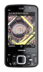
Nokia Maps was updated today with some exciting new features, plus a new offering called Nokia Maps plus Ovi.
 First, looking at the Maps application, the mobile mapping software client has been updated to include high-resolution images, 3D landmarks for 216 cities and terrain maps. Using their relationship with NAVTEQ, Nokia is to giving users high-resolution images so they can pinpoint their location or destination. Additionally, the new Maps version has camera alert spots, and traffic information for select cities (not in North America, unfortunately).
To internet-enable the Maps application, Nokia is tying in the Ovi service to allow users to pre-plan routes on their computer and then sync their mobile with the destination and routing information. Also, users can synchronize their favorite locations between their mobile phone and desktop computers.
With Ovi and Maps combined, you can share your your trips with your friends. As another social feature, you can share your current location with friends within the Maps application using GPS.
As always, you can purchase turn-by-turn driving directions with voice guidance.
Bring Ovi To The Table
It’s great to see Nokia pushing the Ovi services finally. For the longest time, I saw Ovi merely as another account to push photos to, send email from, and so on. I never used it because I already have Flickr, Gmail, and other online services that give me that utility.
However, using Ovi an over-arching services layer, Nokia is building a “cloud” for all our mobile-centric data. Think MobileMe from Apple for everything mobile. Except that Ovi is tied in with NUMEROUS applications and doesn’t cost you $99/year.
Pingback: GPS technology » Blog Archive » Qstarz bt-q1000x bluetooth travel recorder announced